

Featured
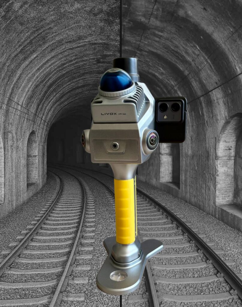
L-40 Handy SLAM
SKU: 1
5.500,00 EUR + VAT
The L-40 Handy SLAM is a cutting-edge 3D laser scanner designed to meet the demands in spatial data capture, 3D modelling, and as-built documentation. Powered by advanced SLAM algorithms and Livox LiDAR technology, it delivers up to 200,000 pts/s and a point cloud range of 40 meters (80 m diameter), ensuring reliable and detailed results.
Brand:
Topogeos
In Stock (2)
Product Description
Compact. Powerful. Precise.Precision Imaging with Professional-Grade Mechanical Shutter
The L-40 is equipped with a mechanical shutter that captures images with global exposure, eliminating the rolling shutter effect. This allows for sharp, accurately coloured point clouds. The shutter is synchronized with the onboard positioning system, ensuring precise spatial alignment of each image. This makes the L-40 Handy SLAM suitable for close-range photogrammetry and detailed 3D modelling.
One-Click Processing & High-Quality Point Clouds
Point cloud data can be exported and integrated with a single operation, streamlining the post-processing workflow. The high-resolution cameras capture detailed, colour-accurate point clouds, suitable for BIM environments and technical documentation requiring precision.
Dual 16MP Sensors for Sharp, Accurate Colour
Equipped with two 1-inch 16MP CMOS sensors (2.4 μm pixel size), the L-40 delivers high-definition images and precisely coloured point clouds.
TopoGEOS Capture App
The L-40 SLAM system includes a dedicated mobile application designed for Android smartphones. The app allows full control of the scanner directly from the field, enabling users to start scans, monitor real-time point cloud acquisition, and manage data processing.
TopoGEOS PointClouds Studio
TopoGEOS PointClouds is the post-processing software developed for the L-40 SLAM system. It converts raw scan data into precise, georeferenced point clouds with tools for SLAM trajectory refinement, noise filtering, and image alignment. Compatible with standard formats and CAD/GIS platforms, it ensures a streamlined and accurate 3D workflow.